Alena Houšková · CC BY-SA 3.0

Recognising is not counting.
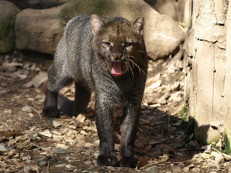
The Jaguarundi has a distinctive shape. Being able to name an animal when it appears does not tell us how many live across a landscape.
Recognizing an animal is not the same as being able to count it
Conceptual comparison, not measured data.Its world.
Its conservation.
Design surveys for an unmarked cat
Because individuals lack reliable coat patterns, monitoring needs methods that do not assume every camera-trap image can identify an animal.
Keep riparian corridors intact
Dense vegetation beside waterways can connect habitat across agricultural and developed landscapes.
Reduce roads and conflict as barriers
Crossing mitigation, safer land planning, and practical poultry protection can reduce avoidable deaths.
Alena Houšková · CC BY-SA 3.0
Keep the method
in the picture.
A camera record supports a detection. Estimating abundance needs an appropriate study design and an account of missed animals.
What don’t we know?
How can surveys produce reliable population evidence across varied habitats?
Geographic context
The Americas.
This is geographic context, not a mapped distribution. Range polygons require taxon, date and reuse review before publication.
A different cat.
A different question.
Sources & Research Notes
Inherited research adapted to the locked editorial lesson; current assessment and independent scientific sign-off pending.
Assessment year and field-data period are different. A source check does not update an assessment.